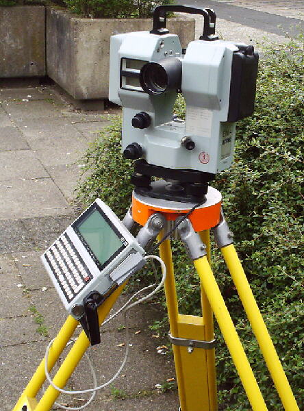
Elta 4 and REC500
A total station with a field-computer
|
General Producer: Carl Zeiss Year: 1988 Price: ca. 23.900DM (1988), technical specifications:
|
|||||||||||||
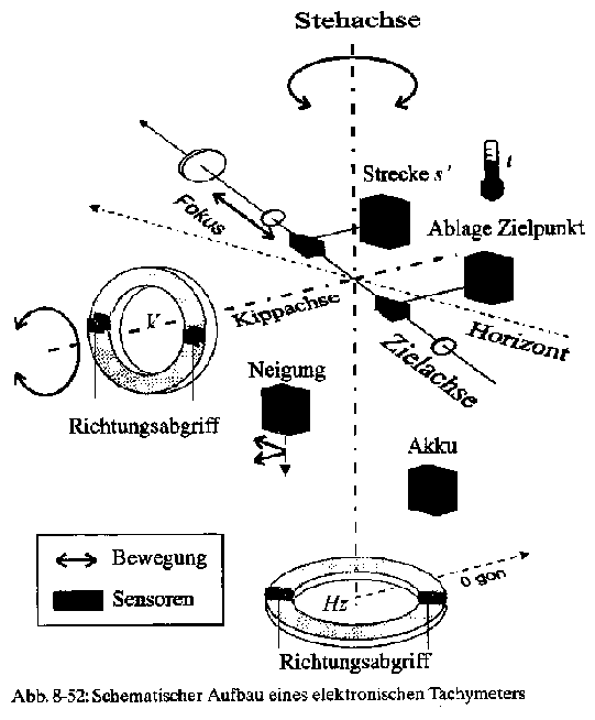
| The schematic
structure of the total station Elta 4 The vertical axis is
the virtual vertical line which should be produced by levelling. By
means of mechanical or electronic steered direct currents and step motors
or even manually you position the objektive (telecope) and the horizontal
axis. The circle is firmly connected with the Elta substructure. The display's
pertain on the device's head part and participale the horizontal rotation.
At the reading appointments for vertical angles it is the opposite: it is
firmly connected in the support, whereas the pitch circle is connected with
the horizontal axis. It takes part of the telescopes vertical rotation.
The metrological registration of physical quantities is called sensors. They gather non-electronical quantities with electricity. A total station is consequently a multi-sensor-system which consists of optical, mechanical and electrical components and are controlled by several micro-processors. |
|
|||||||||||||
| How does a total station function? The total station is able to determine the distance with cm-accuracy, because it is equipped with an integrated or an attachable electric-optical distance meter. For distance measuring you aim the reflector first and then you initiate the measuring-sequence. Finally the device snaps the position of the reflector and shows the deviation to the point you look for. The operator aims at the target at angle measuring and initiates the measurement. The measured values gaining is based on principally electronic scanning of the pitch circle, the consideration of the instrument gardient or the stored correction value and the calculation of the angle value. These data, like horizontal direction, vertical angle and inclined distance are automaticly stored. For example, from an electronic field book, the REC500, which allows a data communication in and out of the calculator. In the past, this field book was a registration- and calculation module, but today an extensive software allows other operating tasks, for example cordinate oriented measurement, surveying calculation and the transfer of data. Consequently you can follow up an automatic data flow from gaining the measuring values to the calculations with an electronic total station. |
Anja Hops and Kathrin Bostelmann, VT02
back