GIS – Geographic Information System
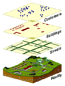
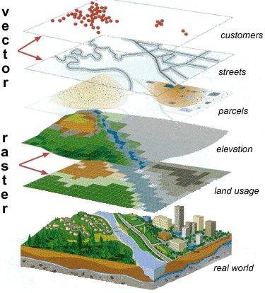
A GIS is a system for capturing, storing, analyzing, managing and presenting data and associated attributes which are spatially referenced to Earth. In the strictest sense, it is any information system capable of integrating, storing, editing, analyzing, sharing, and displaying geographically referenced information.
A GIS expands the potential use of the classical map. In addition to the visualization it plays an important role for the analysis of spatial information.
 |
|
 |
- Its species - Its age - Its rate of injury
|
The use of a
GIS
Geographic
information system technology can be used for:
- scientific investigations
- resource management
- asset management
- environmental impact assessment
- urban planning
- Cartography
- criminology
- history
- sales
- marketing
- logistics
For example, GIS might allow
emergency planners to easily calculate emergency response times in the event of
a natural disaster, it might be used to find wetlands that need
protection from pollution or it can be used by a company to site a new business
location to take advantage of a previously underserved market.